

Book and Go

Austria Weather, climate and geography
Weather & climate
Austria is a year-round destination, although the best time to visit depends largely on the activities planned. Spring (April to May) and autumn (September to October) are particularly pleasant for sightseeing, with generally mild temperatures and fewer visitors than during the main summer season. Summer (June to August) is warm and is the main season for hiking, cycling and holidays around Austria's lakes, although thunderstorms can occur in mountain areas.
Winter (December to March) is the main ski season in the Alps, with resorts in Tirol, Salzburg and Vorarlberg attracting large numbers of visitors. Vienna, Salzburg and other cities are also popular from late November through December for their Christmas markets. Weather varies considerably with altitude, and conditions in the mountains can change quickly at any time of year.
Light to medium-weight clothing is suitable during summer, together with a waterproof jacket for rain and cooler evenings. Warmer layers are advisable when visiting the mountains, even in summer, as temperatures fall with altitude and weather can change rapidly.
Warm winter clothing, including a heavy coat, gloves, hat and suitable footwear, is essential from late autumn through early spring, particularly in Alpine areas. Hikers should carry appropriate footwear, waterproof clothing and extra layers for mountain conditions.
Geography
Austria is a landlocked country in Central Europe, bordered by Germany and the Czech Republic to the north, Slovakia and Hungary to the east, Slovenia and Italy to the south, and Switzerland and Liechtenstein to the west. Covering 83,871 sq km (32,382 sq miles), it stretches approximately 580km (360 miles) from east to west. Vienna lies in the northeast, close to the borders with Slovakia, Hungary and the Czech Republic.
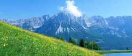
The Alps dominate western and central Austria and cover around two-thirds of the country. The highest and most mountainous terrain lies in Tirol, Salzburg, Carinthia and Vorarlberg, where deep valleys separate high ranges and glaciers. Austria's highest point is the Grossglockner at 3,798m (12,461ft), in the Hohe Tauern range on the border between Carinthia and East Tirol.
The landscape becomes progressively lower towards the east. The foothills of the Alps give way to the Danube Valley, rolling farmland and the Vienna Basin, while Burgenland forms part of the Pannonian Plain that extends into Hungary. Lake Neusiedl, straddling the Austrian-Hungarian border, is a shallow steppe lake surrounded by extensive reed beds and wetlands, contrasting sharply with the Alpine lakes of western Austria.
The Danube is Austria's most important river, entering from Germany near Passau and flowing east through Linz, the Wachau Valley and Vienna before continuing into Slovakia. Numerous Alpine rivers, including the Inn, Salzach, Enns and Drava, form important valleys and tributaries. Austria also has many lakes, particularly in the Salzkammergut and Carinthia, where lakes such as Attersee, Wolfgangsee and Wörthersee are prominent features of the landscape.
Austria is divided into nine federal states: Burgenland, Carinthia, Lower Austria, Upper Austria, Salzburg, Styria, Tirol, Vorarlberg and Vienna. Lower Austria is the largest by area and surrounds Vienna on three sides, while Vienna is both the national capital and a federal state in its own right. The concentration of population and agriculture in the lower eastern regions contrasts with the more sparsely populated mountain areas of the west and centre.
Do you have any Feedback about this page?
© 2026 Columbus Travel Media Ltd. All rights reserved. No part of this site may be reproduced without our written permission, click here for information on Columbus Content Solutions.



 You know where