
Zambia Weather, climate and geography
Weather & climate
Zambia has a tropical climate with three main seasons that are useful for travellers to understand when planning a visit. The dry season runs from May to October and is generally considered the most comfortable time to travel. During this period, daytime temperatures typically range from 18°C to 28°C (64°F to 82°F), with cooler nights, especially between June and August, when early mornings can be quite chilly.
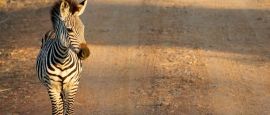
This dry season is also the best time for safari travel. From June to October, vegetation is sparse and water sources are limited, causing wildlife to congregate around rivers and waterholes. This makes animals easier to spot, particularly in national parks such as South Luangwa and Lower Zambezi. September and October offer excellent game viewing, although temperatures are higher toward the end of this period.
The hot dry season follows from September to November and is the warmest time of year. Temperatures during these months often range from 25°C to 35°C (77°F to 95°F), particularly in low-lying areas such as the Zambezi Valley. This period can feel intense, especially in October, but it remains popular for safari enthusiasts seeking peak wildlife concentrations.
The rainy season lasts from November to April, with the heaviest rainfall usually between December and February. Temperatures during this season generally range from 20°C to 30°C (68°F to 86°F). Rain often falls in short, heavy showers rather than all day, and the landscape becomes lush and green. From February to May, following the peak rains, Victoria Falls is at its most powerful, with the greatest volume of water and dramatic spray, making this the best time to experience the falls at full force. In contrast, lower water levels from August to November provide clearer views of the rock formations and are ideal for activities such as white-water rafting.
Lightweight, breathable clothing is suitable for most of the year, particularly during the hotter months. Natural fabrics such as cotton and linen are comfortable in Zambia's warm climate. During the dry winter season from May to August, visitors should bring warmer layers for evenings and early mornings, especially in higher-altitude areas.
For the rainy season from November to April, rain protection such as a light waterproof jacket, poncho or compact umbrella is recommended, as showers can be sudden and heavy. Comfortable walking shoes are useful year-round, particularly for safaris, sightseeing and uneven terrain. Neutral-coloured clothing is often preferred for wildlife viewing, while modest dress is advisable in towns, rural areas and when visiting religious or cultural sites.
Geography
Zambia is a landlocked country in southern Africa, bordered by Angola to the west, the Democratic Republic of the Congo to the north, Tanzania to the north-east, Malawi to the east, Mozambique to the south-east, Zimbabwe to the south, Botswana and Namibia to the south-west. Its central location makes it a natural crossroads between southern, eastern and central Africa.
The country lies largely on a high plateau at around 1,000 to 1,400 metres above sea level, which gives Zambia a more moderate climate than many of its neighbours. The landscape is dominated by savannah, woodland and river systems, with relatively few mountains. This terrain supports extensive wildlife habitats and agriculture.
Zambia is defined by its rivers. The Zambezi River, one of Africa's longest rivers, forms much of the southern border and is home to Victoria Falls. Other major rivers include the Kafue and Luangwa, which support important national parks. Zambia's highest point is Mafinga Central at 2,339 metres, while the lowest point lies along the Zambezi Valley at around 329 metres above sea level.
Do you have any Feedback about this page?
© 2026 Columbus Travel Media Ltd. All rights reserved. No part of this site may be reproduced without our written permission, click here for information on Columbus Content Solutions.


 You know where