
Mali Weather, climate and geography
Geography
Mali is a landlocked republic, sharing borders with Mauritania, Algeria, Burkina Faso, Côte d'Ivoire, Guinea, Niger and Senegal. It is a vast land of flat plains fed by two major rivers, the Senegal on its western edge and the great River Niger. On its journey north the Niger converges with the River Bani, and forms a rich inland delta, the marshlands of the Macina, stretching for some 450km (280 miles) along the river's length, in some places 200km (124 miles) wide. The central part of the country is arid grazing land, called the Sahel, which has suffered great drought.
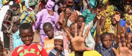
At Timbuktu, the Niger reaches the desert and here it turns first to the east, then to the southeast at Bourem, where it heads for the ocean. In the desert, near the Algerian and Niger borders in the northeast, the Adrar des Iforas massif rises 800m (2,625ft). The north of the country is true desert except for the few oases along the ancient trans-Saharan camel routes. Tuaregs still live around these oases and camel routes. Further south live the Peulh cattle-raising nomads. The majority of the population lives in the savannah region in the south. The peoples of this region comprise Songhai, Malinke, Senoufou, Dogon and the Bambara (the largest ethnic group).
Do you have any Feedback about this page?
© 2026 Columbus Travel Media Ltd. All rights reserved. No part of this site may be reproduced without our written permission, click here for information on Columbus Content Solutions.


 You know where